To see accurate pricing, please choose your delivery country.
 
 
United States
£ GBP
All Shops

British Wildlife

8 issues per year 84 pages per issue Subscription only

British Wildlife is the leading natural history magazine in the UK, providing essential reading for both enthusiast and professional naturalists and wildlife conservationists. Published eight times a year, British Wildlife bridges the gap between popular writing and scientific literature through a combination of long-form articles, regular columns and reports, book reviews and letters.

Subscriptions from £33 per year

Conservation Land Management

4 issues per year 44 pages per issue Subscription only

Conservation Land Management (CLM) is a quarterly magazine that is widely regarded as essential reading for all who are involved in land management for nature conservation, across the British Isles. CLM includes long-form articles, events listings, publication reviews, new product information and updates, reports of conferences and letters.

Subscriptions from £26 per year
Academic & Professional Books  Reference  Data Analysis & Modelling  Cartography, Remote Sensing, Image Analysis & GIS

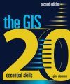
The GIS 20 Essential Skills

Textbook Handbook / Manual
By: Gina Clemmer(Author)
165 pages, 147 illustrations
Publisher: ESRI Press
The GIS 20
Click to have a closer look
  • The GIS 20 ISBN: 9781589483224 Edition: 2 Paperback Aug 2013 Not in stock: Usually dispatched within 1-2 weeks
    £49.99
    #238449
Price: £49.99
About this book Contents Customer reviews Biography Related titles

About this book

The GIS 20: Essential Skills presents step-by-step instructions, illustrations, and practical tips on how to perform the top twenty skills needed to successfully use a geographic information system (GIS). These skills include finding and editing data, querying GIS maps, creating reports, and sharing and publishing your maps. The second edition offers nine bonus topics to further advance your skills, exercise data on the accompanying DVD, and ArcGIS 10.1 for Desktop software (180-day use) to work through the exercises.

Contents

Introduction

Chapter 1: Downloading shapefiles and using essential ArcMap tools
Chapter 2: Creating basic maps and layouts
Chapter 3: Projecting shapefiles
Chapter 4: Preparing data for ArcMap
Chapter 5: Joining data to maps
Chapter 6: Creating thematic maps
Chapter 7: Working with data tables
Chapter 8: Address mapping
Chapter 9: Creating a categorical map
Chapter 10: GPS point mapping
Chapter 11: Editing
Chapter 12: Creating attribute queries
Chapter 13: Creating location queries
Chapter 14: Using geoprocessing tools
Chapter 15: Creating geodatabases
Chapter 16: Joining boundaries
Chapter 17: Working with aerial photography
Chapter 18: Creating reports
Chapter 19: Sharing work
Chapter 20: Publishing maps

About bonus exercises
Bonus 1: Understanding common file types
Bonus 2: Advanced labeling
Bonus 3: Creating custom symbology
Bonus 4: Exporting to KML format
Bonus 5: Esri Maps for Microsoft Office
Bonus 6: Metadata
Bonus 7: Working with multiple data frames
Bonus 8: Enabling time
Bonus 9: Creating map books

A note to the reader
Data and image source credits
Data license agreement
Index

Customer Reviews

Biography

Gina Clemmer, president of the research and training company New Urban Research, Inc., has trained thousands of new GIS users from across the United States. Clemmer holds a master's degree in urban planning from the University of Iowa.

Textbook Handbook / Manual
By: Gina Clemmer(Author)
165 pages, 147 illustrations
Publisher: ESRI Press
Current promotions
New and Forthcoming BooksBritish Wildlife Magazine SubscriptionNHBS Moth TrapBuyers Guides