To see accurate pricing, please choose your delivery country.
 
 
United States
£ GBP
All Shops

British Wildlife

8 issues per year 84 pages per issue Subscription only

British Wildlife is the leading natural history magazine in the UK, providing essential reading for both enthusiast and professional naturalists and wildlife conservationists. Published eight times a year, British Wildlife bridges the gap between popular writing and scientific literature through a combination of long-form articles, regular columns and reports, book reviews and letters.

Subscriptions from £33 per year

Conservation Land Management

4 issues per year 44 pages per issue Subscription only

Conservation Land Management (CLM) is a quarterly magazine that is widely regarded as essential reading for all who are involved in land management for nature conservation, across the British Isles. CLM includes long-form articles, events listings, publication reviews, new product information and updates, reports of conferences and letters.

Subscriptions from £26 per year
Academic & Professional Books  Reference  Data Analysis & Modelling  Cartography, Remote Sensing, Image Analysis & GIS

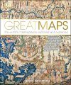
Great Maps The World's Masterpieces Explored and Explained

Popular Science
By: Jerry Brotton(Author)
256 pages, colour & b/w illustrations
Great Maps
Click to have a closer look
  • Great Maps ISBN: 9781409345718 Hardback Sep 2014 Not in stock: Usually dispatched within 5 days
    £27.00
    #216926
Price: £27.00
About this book Customer reviews Biography Related titles

About this book

Great Maps takes a close look at the history of maps, from ancient maps such as medieval mappae mundi to Google Earth. Why do we put north at the top of maps? Which maps show us the way to Heaven, and which show the "land of no sunshine" or the land of "people with no bowels"? In Great Maps, author and historian Jerry Brotton tells the hidden story behind more than 60 of the most significant maps from around the world, picking out key features, stories, and techniques in rich visual detail to reveal the inner meaning buried within the landscape.

Maps are not just geographical data: they reflect a particular ideological, historical, or cultural context. Providing a unique insight into how mapmakers have used maps to shape and depict their world view, this beautifully illustrated book traces the development of human development and culture through its maps. From the earliest rock carvings to the latest geospatial technology, from ancient medieval mappae mundi to the first road atlas, Great Maps explores in stunning photographic detail how maps have influenced and reflected our world throughout history.

Customer Reviews

Biography

Jerry Brotton is Professor of Renaissance Studies at Queen Mary University of London, and a leading expert in the history of maps and Renaissance cartography. He is the author of A History of the World in Twelve Maps and The Sale of the Late King's Goods: Charles I and His Art Collection, which was shortlisted for the Samuel Johnson Prize and the Hessell Tiltman History Prize. He also presented the BBC television series Maps: Power, Plunder and Possession.

Popular Science
By: Jerry Brotton(Author)
256 pages, colour & b/w illustrations
Current promotions
New and Forthcoming BooksBest of WinterNHBS Moth TrapBuyers Guides